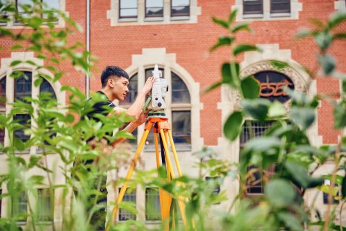
Surveying
All services from the first idea, through the planning phase on to completion of the project
Your advantages
Reliable
We have been on the market for 29 years. Up to 40 employees are at your disposal in the greater Berlin, Saxony, Hesse and Baden-Württemberg area. With our local offices we assure you short distances for your surveying tasks. For large projects our offices support each other. You can expect an uncomplicated and conscientious performance from us.

Short response times
The construction site business is well known to us. With up to 30 different call-offs daily, our work ensures that construction sites progress on schedule. Just-in-time, so to speak. Make uncomplicated arrangements with us. We will promptly present you with a solution to your surveying requirements.

Communication
Talk to us via mail, phone or online meeting. We are available for you at any time. Our expertise allows you to communicate with us at eye level. Due to our extensive experience in civil and structural engineering up to complex PPP projects, we can provide you with first-class advice.

Engineering and technologies
With our own department for mass determination, we are at your billing team's side. BIM in civil engineering is our passion. Trained employees model your construction measures according to your accuracy specifications and content requirements. With the help of BIM-to-Field we show you the deviation to the project still on the construction site. Using mobile laser scanners, we record your construction site progress in the shortest possible time and thus document your work. With flat hierarchies, we ensure agile execution of your commissioned services.
Spectrum:
Due to tight costs and budgets for construction projects an equally exact and fast recording of the current inventory, a documentary of the building progress or a preservation of evidence is required at the building site. Using modern procedures like mobile mapping, laser scanning or surveying by drones we meet these requirements. Depending on the case the registration of, amongst others, the topography, buildings, supply- and or waste pipelines will be made. From these recorded measuring values, it is possible to create as-built plans- and documentations, quantity calculations and digital terrain models. The conversion of the data is to be made in accordance with the procedures of the client as well as current standards and norms. With its numerous interfaces the data will be converted into the common CAD-formats.
- Mobile mapping
- Surveying with drones
- As- built plans- and documentation
- Registry of supply- and waste pipelines
- Documentary of the building process or preservation of evidence
- Data conversion/ data management
To support the conversion of your building project, exact site and grading plans, 3D terrain - and 3D models serve as a planning basis. Therefore, the existing control framework or bench mark field will be checked. New control points will be created and the topography will be recorded.
By using state-of-the-art surveying technology, high efficiency is ensured. In the field service we employ the most modern tachymeters and levels by the companies Leica and Trimble. Using our laser scanners, we record the inventory even in difficult conditions and in the shortest of time. For capturing the original terrain of large areas and the survey of inaccessible objects, we utilize a drone. You will receive the data according to your specifications and the current standards and norms.
As experts, we create site plans for the building application according to current building codes. Because of years of experience, we have tremendous know-how and longstanding expertise especially in difficult property- , building- and ceiling ratio. Detlef Wuttke as the publicly appointed surveyor and his team are specialists concerning the codes of distance space.
Conception, construction and map revision of the general control network Design measurement/ Site- and grading plans 3D terrain models Site plans for the building application/ site plans for the public easement register
- Conception, construction and map revision of the general control network
- Design measurement/ Site- and grading plans
- 3D terrain models
- Site plans for the building application/ site plans for the public easement register
During construction or restructuring as well as the following usage of buildings, deformations will occur. With the help of control- and monitoring surveys the appearing deformations and settlements will be documented. For the surveying monitoring of buildings, we employ high-precision measuring methods like tacheometry, precision levelling, photogrammetry and laser scanning. Moreover, we have experience in the automation of these procedures. In any case, we are able to create measuring programs and we will be glad to advise you at any time.
- Precision levelling
- Motion- and deformation measurement
- monitoring of buildings
In setting outs, the planning will be transferred precisely into the location and will be marked. Whereas in fine marking-outs the exact position of planned buildings, foundations, axes, abutments and pipelines are made visible. We are working for a large variety of sectors such as building-, road- and track construction as well as for civil engineering.
To any upcoming particular demand, we respond with speed and flexibility and we adapt to your construction schedule. With up to 30 survey teams we are able to offer nearly every service necessary concerning engineering surveys.
- Surveying during construction and setting out for building-, road- and track construction as well as for civil engineering
- Building survey/ rough- and fine marking out
Quantity calculations are required in order to calculate construction costs and material consumption concerning the construction of traffic routes and landscaping measures as well as for squaring the actual construction effort for instance in earthworks.
Prior to tender procedure we will gladly examine the original terrain information and provide a mass calculation on the basis of provided planning documents both analogue and digital. During the construction we support you in setting the costs for construction measures, we compile complete mass- and quantity calculations concerning the guidelines of REB (“Regelungen für die elektronische Bauabrechnung”) on the basis of the billing arrangements described in the construction contract.
- Quantity survey prior to tender procedure, mass calculation
- Mass calculation and billing according to the guidelines of REB
- Distribution plans concerning masses
Control data for construction machinery The preparation of data concerning the construction machinery guidance including complete terrain models for the use of caterpillars, diggers and graders. You will receive the control data in your desired format for instance by Trimble, Leica or Topcon
3D driving simulation of transport routes, calculation of tractrix curves, steering angle- and driving period diagrams On the basis of your planning data we simulate your construction project in the local area. With the help of your requirements, we calculate the tractrix curves. You will get a center line calculation as well as a video showing the driveways.
Calculation of gradients In the renovation of engineering work it is necessary to recalculate the gradient and the draft following the pulling down of layers in order to guarantee a steady transition from the old stock. You will get a new gradient as well as a surface structure and a centre line calculation.
3D print of surface models The spatial expression by means of a 3D printer provides you with the opportunity of the plastic embodiment of your construction project for instance for your presentations.
For the engineering of industrial plant, 3D models form the basis. If the existing industrial plants will be extended or converted, a 3D scan and the creation of a digital 3D model are indispensable. The generated models simplify the planning process and enable correct collision analyses between the actual inventory and planning. Furthermore, the digital factory is simplifying the work of facility management (maintenance, service) as well as the work of casuality-, property- and catastrophe management. Additionally, complex visualizations of point clouds and 3D models of small and large components will be made possible. We will advise you over the entire course of project concerning geodetic and surveying issues. It starts from the adopting of a common measuring concept and leads up to high-precision surveying and right up to the evaluation of the results to suit your own individual preferences and requirements.
By means of tacheometry, laser tracking and photogrammetry we are able to capture the high-precision measurement of deformations of machines, industrial plants and other components. The aim of control- and monitoring measurements for industrial plants is to determine, whether a geometric alteration (deformation) of a component or a machine is in the tolerance given (target-actual-comparison).
Industrial cranes are exposed to tough conditions. To ensure proper functionality, the crane runway must be tested at regular times for their correct position and height, parallelism as well as equal height. As a result of wear and tear and for the building and restructuring of cranes, crane runway surveys are periodically necessary (mounting inspection). The results will be documented by a protocol and are presented in a clearly understandable manner.
For establishing and adjusting machines as well as production facilities, staking-out procedures in the sub-millimetre range are required. The high accuracies are in need to guarantee the functionality of the industrial plant. Especially important is the determination of a unified reference system. In general, this is a local system with regard to the plant, to individual axes or to the machine itself. In addition to required technical equipment, we have the necessary special know-how to perform stake-outs with ease. We are your partners in all matters with regard to the stake-out of industrial plants, machines and production lines.